Loading data into PostGIS with pgShapeloader
The pgShapeloader tool (also known as “PostGIS Shapefile Import/Export Manager” or “PostGIS Shapefile and DBF loader”) provides another option for loading shapefiles into PostGIS database tables. It is the graphical user interface (GUI) equivalent of the command line shp2pgsql tool.
Note
This section uses the command line utility shp2pgsql, the graphical utility pgShapeloader and optionally the graphical utility pgAdmin. These tools may not be automatically present, depending on the type of installation of OpenGeo Suite. Please see the Installation section for information on how to install these tools for your platform.
Note
On Linux systems, pgShapeloader is known as shp2pgsql-gui.
How it works
Like all graphical tools, pgShapeloader is designed for ease of use, while at the same time retaining most of the functionality of the more flexible command line tool. The pgShapeloader tool combines the two data loading stages, converting data into SQL commands and running those commands against the target database, into one operation.
Preparation
- Select a shapefile to load—you will need all the files:
.shp,.shx, and.dbfand so on. - Identify the SRID (“projection”) of your data. If available, this information is easily accessed via the layer metadata in GeoServer. If the projection is unknown, use a service like prj2epsg.org to upload and convert the shapefile’s
.prjfile to a SRID code. - Either identify the target database where you would like to load the data, or create a new database.
Launching pgShapeloader
Depending on how OpenGeo Suite was installed pgShapeloader may or may not have been installed. See the Installation section for installation instructions. Once installed follow the instructions below for your platform.
Windows
On Windows pgShapeloader can be launched from the Start Menu.
Mac
On Mac the pgShapeloader application is accessible from the installer image under PostGIS Utilities.
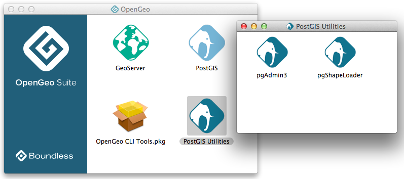
Launching pgShapeloader on Mac
Linux
On Linux pgShapeloader can be launched from the terminal with the shp2pgsql-gui command.
Loading data
Make sure OpenGeo Suite is running and launch pgShapeloader.
Click View connection details and enter the connection information in the PostGIS Connection section. This information will depend on how the OpenGeo Suite was installed, and whether
pgShapeloaderis running locally or remotely. For a default local installation, the following connection info may be used:Username postgres Password [blank/any] Server Host localhost Port 5432 
PostGIS connection options
Click OK to return to the main application. The shapefile loader uses the supplied connection details to connect to the target database; the connection status is reported in the Log Window. If you see any errors, check your details and try again.

A successful PostGIS connection
To select your source files, click Add File to open the Select a Shape File dialog box. Navigate to the location of your shapefile, click the shapefile you wish to load, and click Open. Multiple files can also be added in the same way.

Selecting a shapefile to import
Edit the configuration information for each item in the Import List to provide the correct SRID for each shapefile.
Warning
Do not omit this step, otherwise your data will not load properly.

Changing the SRID
Other import options are available to configure. Click Options to open the Import Options dialog box.

Additional options
The import options are:
Option Description DBF file character encoding Specifies the character encoding of the shapefile’s attribute columns. Default is UTF-8. Preserve case of column names If this option is not selected, all column names will be lower case. Select this option to preserve mixed case. Do not create ‘bigint’ columns Columns with type ‘bigint’ will not be created. Create spatial index automatically after load Creates a spatial index automatically. Indexing is recommended for improved performance reasons, but if you wish to create the index manually or if you’re sure you don’t want one, clear the check box. Load only attribute (dbf) data Strips the geometry column from the loading process, leaving just the attribute columns. Default is unselected. Load data using COPY rather than INSERT This can sometimes improve the performance of the load process. Load into GEOGRAPHY column Will load the geospatial data as type GEOGRAPHY instead of the default of GEOMETRY. Requires lat/lon data (SRID 4326). Generate simple geometries instead of MULTI geometries Override the default behavior of importing multipolygons Note
If you are unsure about the implications of making further changes, leave the default values as they are and click OK to return to the main dialog box.
Once all import options have been configured, click OK and click Import to start the conversion.

Import in progress
On successful completion, the shapefile has been imported as a table in your PostGIS database.

A successful import
You can verify this in
pgAdminby viewing the list of tables in the Object browser—your new table should be listed.
Confirming import in pgAdmin
You can also verify a successful import operation at the command line by typing:
psql -U <USERNAME> -d <DATABASE> -c "\d"Note
The specific command parameters will depend on your local configuration.
 Schema |         Name         |   Type   |  Owner
--------+----------------------+----------+----------
 public | geography_columns    | view     | postgres
 public | geometry_columns     | view     | postgres
 public | raster_columns       | view     | postgres
 public | raster_overviews     | view     | postgres
 public | spatial_ref_sys      | table    | postgres
 public | us_cities            | table    | postgres
 public | us_cities_gid_seq    | sequence | postgres