Identify
The Identify tool will return attribute information for any features, in all visible layers, identified at a given location in the Map Window.
To activate this tool, click Identify on the GeoExplorer toolbar.
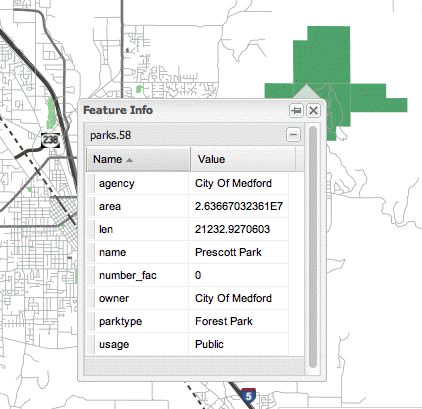
Identify tool
With the Identify tool activated, click a location on the map. If a feature is found at that location, the Feature Info dialog box will be displayed, listing the feature’s attribute information. If no features are found at that location, the Feature Info dialog box will not open.
Identify
Note
You can’t use the Identify tool to identify features in a Base Maps layer.
If multiple features are found at that location, multiple layers will be listed in the Feature Info dialog box. Click a layer name to expand its attribute list.
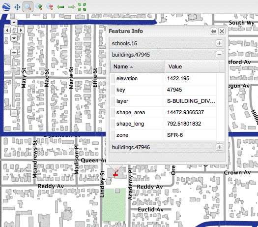
Identifing multiple features
Note
The feature information displayed is the server’s response to a WMS GetFeatureInfo request. This is typically a tabular listing of features and attributes, and is read-only in GeoExplorer. To customize the HTML output of the GetFeatureInfo request, edit the settings on the server.