Sample Data
OpenGeo Suite comes with some preloaded sample layers that may be viewed and restyled as required.
Note
The sample layers are provided for demonstration purposes only. No assurances are provided with respect to the currency or accuracy of the data.
Included data
States
A population distribution layer for the United States of America taken from the 2010 Census. See the U.S. Census Bureau for more details.
The usa:states layer is in a geographic projection (EPSG:4326) with an approximate spatial extent of -179.2, 17.8, -65.2, 71.4 (west, south, east, north).
Countries
A world wide country layer taken from the Natural Earth 1:50m cultural vector dataset.
The opengeo:countries layer is in a geographic projection (EPSG:4326) with a full world extent.
Available data
The following data is available as separate downloads:
Medford
The city of Medford, in the United States state of Oregon, has generously shared some of their public domain municipal data.
Note
To install the data download medford.zip and unpack it into the root of the GeoServer data directory.
The following layers are available in the Medford dataset:
| Layer Name | Abstract | Last Updated | Type |
|---|---|---|---|
| medford:bikelanes | Bike lanes in Jackson County | Dec 2008 | MultiLineString |
| medford:buildings | Building outlines for Medford | Mar 2009 | MultiPolygon |
| medford:citylimits | Local jurisdiction of Medford | Jul 2009 | MultiPolygon |
| medford:firestations | Location of fire stations in Jackson County | Apr 2009 | Point |
| medford:hospitals | Location of hospitals in Jackson County | Oct 2006 | Point |
| medford:hydro | US Fish & Wildlife National Wetlands Inventory of wetland linear features | Oct 2000 | MultiLineString |
| medford:libraries | Location of libraries in Jackson County | Aug 2006 | Point |
| medford:parks | Open parks within Medford | Unknown | MultiPolygon |
| medford:police | Location of police stations in Jackson County | Apr 2009 | Point |
| medford:schools | Location of Jackson County schools | Mar 2009 | Point |
| medford:stormdrains | Storm drains within Medford | Unknown | MultiLineString |
| medford:streets | All public streets within Jackson County | Sept 2009 | MultiLineString |
| medford:wetlands | US Fish & Wildlife National Wetlands Inventory of Jackson County | Oct 2009 | MultiPolygon |
| medford:zoning | City Zones from the Jackson County City Planning | Apr 2008 | MultiPolygon |
| medford:taxlots | Property tax land parcels | 2009 | MultiPolygon |
| medford:elevation | 50 Meters USGS 30 Meter Digital Elevation Model color shaded relief of Medford | Jan 2001 | GeoTIFF |
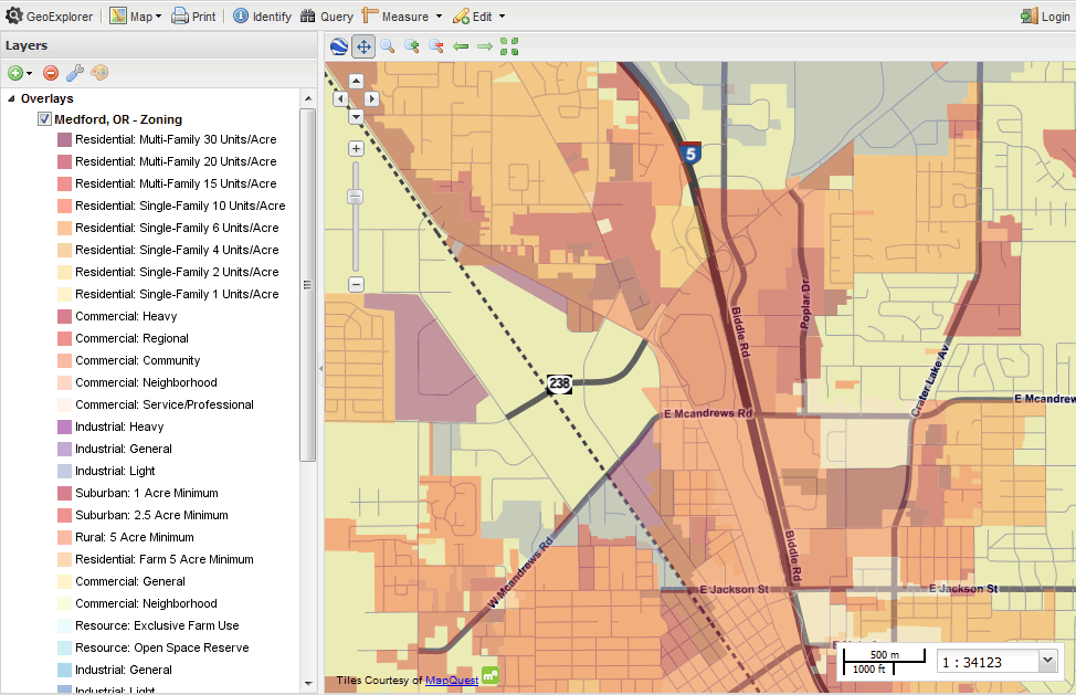
Medford zoning data viewed in GeoExplorer
The Medford layers are in a geographic projection (EPSG:4326) with an approximate spatial extent of -122.904, 42.231, -123.042, 42.438 (west, south, east, north).
World
A variety of world wide datasets compiled from a number of sources.
Note
To install the data download world.zip and unpack it into the root of the GeoServer data directory.
Note
The world data bundle contains styles that require the GeoServer WPS extensions.
The world layers include:
| Layer Name | Abstract | Type |
|---|---|---|
| world:volcanoes | Major volcanoes | Point |
| world:globaldata_temp | Maximum daily temperatures | Point |
| world:urbanareas1_1 | Urban population | Point |
| world:cities | Major cities | Point |
| world:borders | Continental outlines | MultiPolygon |
The world layers are in a geographic projection (EPSG:4326).
The world:volcanoes layer is derived from the freely available volcano data compiled by the Smithsonian Institute, Global Volcanism Program. The world:globaldata_temp layer is derived from the NASA GLOBE Program and again is freely available. (GLOBE data is only available for locations in countries that have joined the GLOBE Program.)
The world:urbanareas1_1 layer was obtained from the Nordpil world database of large urban areas, derived from the World Urbanization Prospects: The 2007 Revision Population Database (UN Population Division). The urban areas data is made available under a Creative Commons public domain license.
The world:cities layer was derived from public domain data obtained from the Natural Earth website. The world:borders layer was downloaded from the Mapping Hacks website. The original data was derived from public domain sources.
For further information, please refer to the Readme.txt file included with the data.
Base Maps
GeoExplorer provides a link to the MapQuest OpenStreetMap (OSM) web service, providing a general map of the world as a base map.
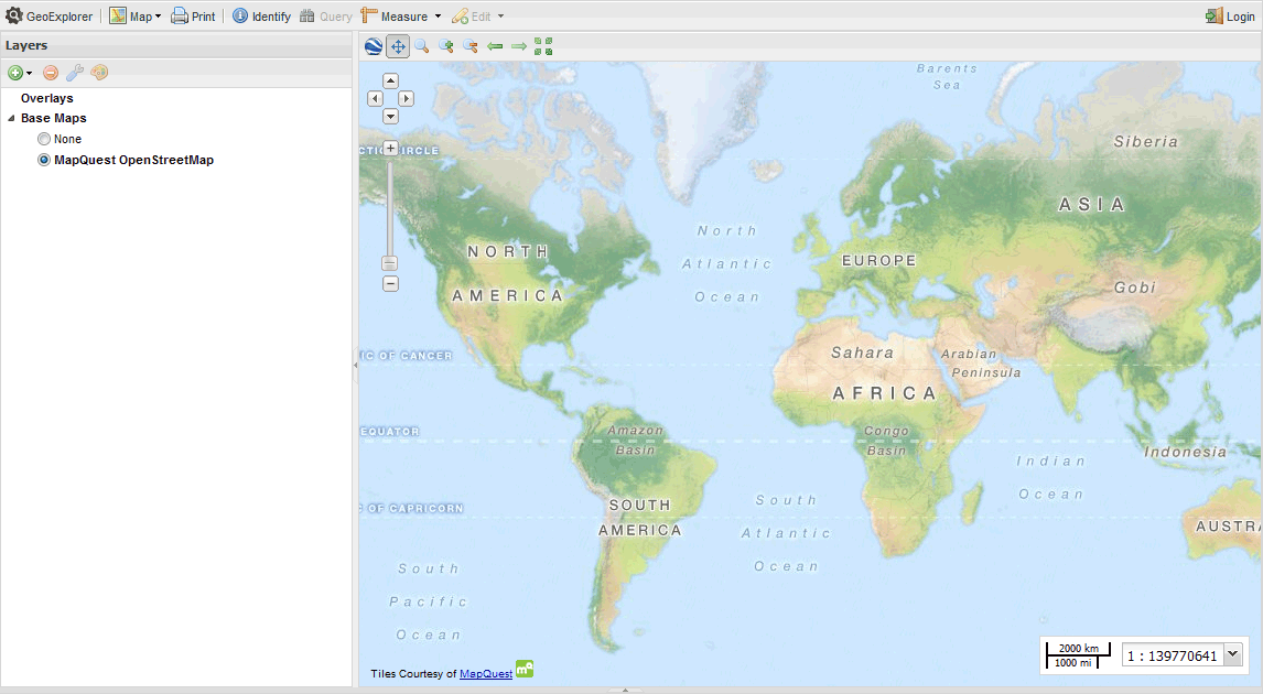
OSM world map in GeoExplorer